Global Coverage, High Resolution
We provide high-resolution elevation data for all terrestrial areas across the globe, primarily using the Copernicus 30m (GLO-30) dataset, which offers near-complete global land coverage.
In the rare regions where 30m data is unavailable, we automatically fall back to the reliable Copernicus 90m (GLO-90) dataset—ensuring seamless, gap-free elevation data for all land surfaces.
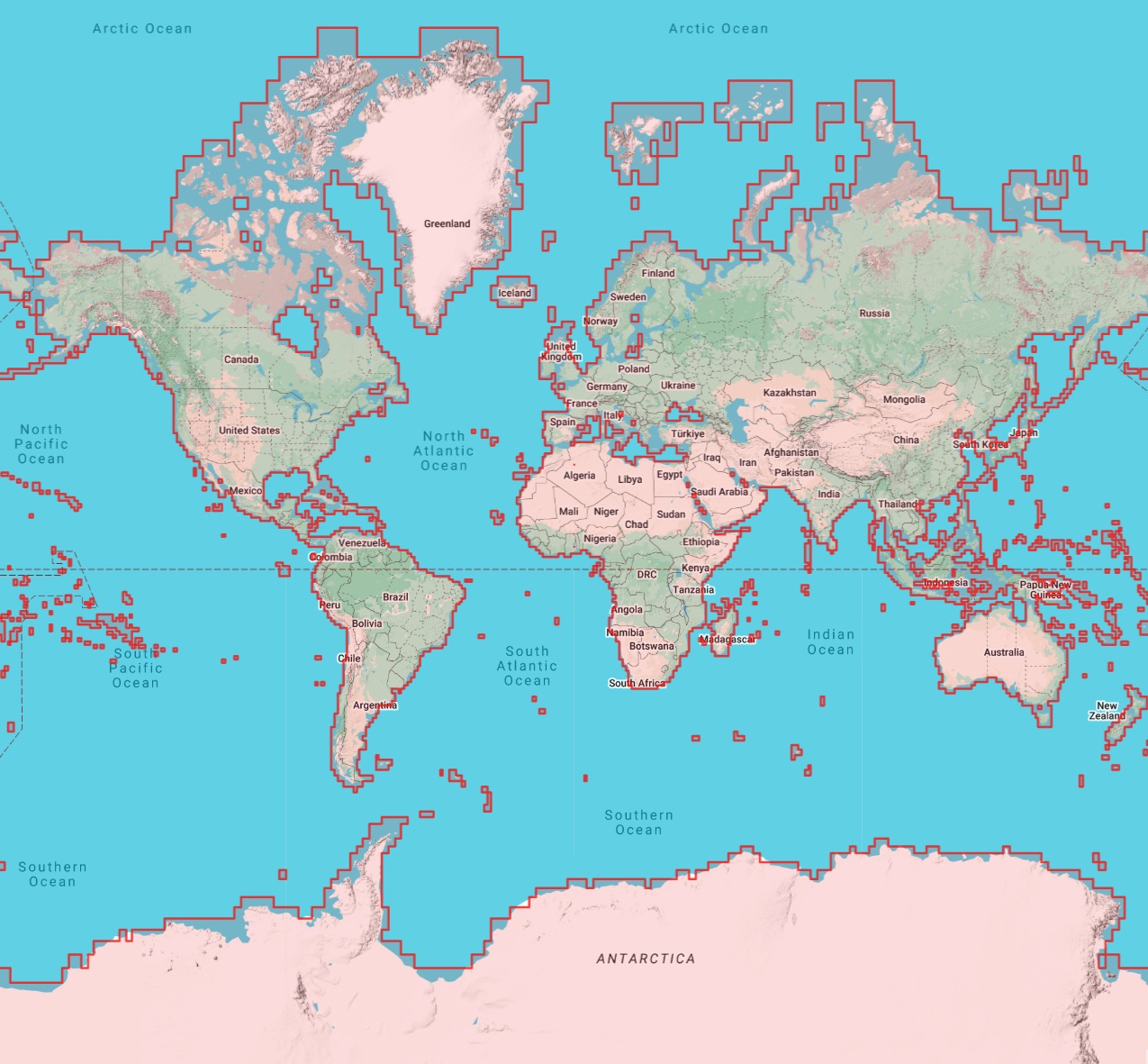
The red outline indicates the area covered by our elevation tiles. This dataset includes 100% of Earth's terrestrial surface
Easy Migration & Usage
TerrainTap is a fast and affordable drop-in replacement for the Google Elevation API. To get started, get a free API key and see our comprehensive documentation.
# Example Request
curl "https://api.terraintap.com/elevation/json?locations=46.8182,8.2275&key=YOUR_API_KEY"

# Example Response
{
  "results": [
    {
      "elevation": 418,
      "location": {
        "lat": 46.8182,
        "lng": 8.2275
      },
      "resolution": 30
    }
  ],
  "status": "OK"
}
Pricing
Choose the plan that fits your application's needs. All plans include access to our high-performance global elevation API with the same fast response times and data quality.
Get Your API Key
Already have a subscription?
Manage it by entering your email and clicking "Manage Subscription". We'll send you a secure magic link to manage your plan or retrieve your API key.
Need Help?
If you have questions about getting started, require support with integration, or would like to discuss your specific use case, please contact us. We typically respond within one business day. We value every inquiry and are committed to providing the support you need.
Get in touch: info@terraintap.com
About the service
This elevation service was built from the ground up to deliver high-performance global terrain data cost-effectively for mapping applications, GIS systems, and location-based services. At its core is a custom-built, high-throughput backend designed to run close to the metal, leveraging modern CPU and memory architectures. Its spatially-aware caching system continuously analyzes access patterns and geographic relevance to determine which parts of the multi-terabyte dataset to keep in RAM and which to offload to disk. This results in extremely fast response times, even under heavy load. The system is lean, efficient, and engineered for real-world performance at scale.
We're continually looking for ways to improve the service, so if you have a suggestion for how to do that, or a dataset you would like to have added to the service, feel free to drop us a mail at info@terraintap.com